History
Salem through the ages
From a quiet New Hampshire parish to one of the state's largest towns: more than 275 years of growth, change and resilience.
Population, 1790 to today
From 1,218 residents at the first U.S. Census to about 31,673 in the Census Bureau’s 2024 estimate.
Events that shaped Salem
1750
Town incorporated
Salem was incorporated as a town, separating from the Methuen parish. It was named after Salem, Massachusetts, where many of its earliest settlers came from.
1775
American Revolution
Salem residents answered the call to arms at Lexington and Concord. The town sent soldiers and supplies to the Continental Army throughout the war for independence.
1804 · est. population 1,118
Londonderry Turnpike incorporated
The Londonderry Turnpike was incorporated as a toll road connecting Concord to Windham and Salem. Running along what is now Route 28, it became the town's main north-south road, linking Salem to markets in Boston and the Merrimack Valley. It brought stagecoach traffic, taverns and commerce to the center of town. (Source: Doug Seed, Merrimack Valley Life)
1902 · est. population 2,056
Canobie Lake Park opens
Built as a trolley park at the end of the Massachusetts Northeast Street Railway line, Canobie Lake Park drew visitors from across the region. The electric trolley brought thousands to the shores of Canobie Lake and made Salem a recreation destination.
1904 · est. population 2,071
Turnpike paved
At a special town meeting, residents voted to let Edward F. Searles macadamize the turnpike from the state line to Salem Depot, including Hampshire Street to the state line. That joined the macadam road from Methuen and made one unbroken stretch of good road from Lawrence to the Depot. Two other landowners, Charles H. Tenney and Levi Woodbury, finished the work from the Depot to the Windham line. (Source: Doug Seed, Merrimack Valley Life)
1906 · est. population 2,087
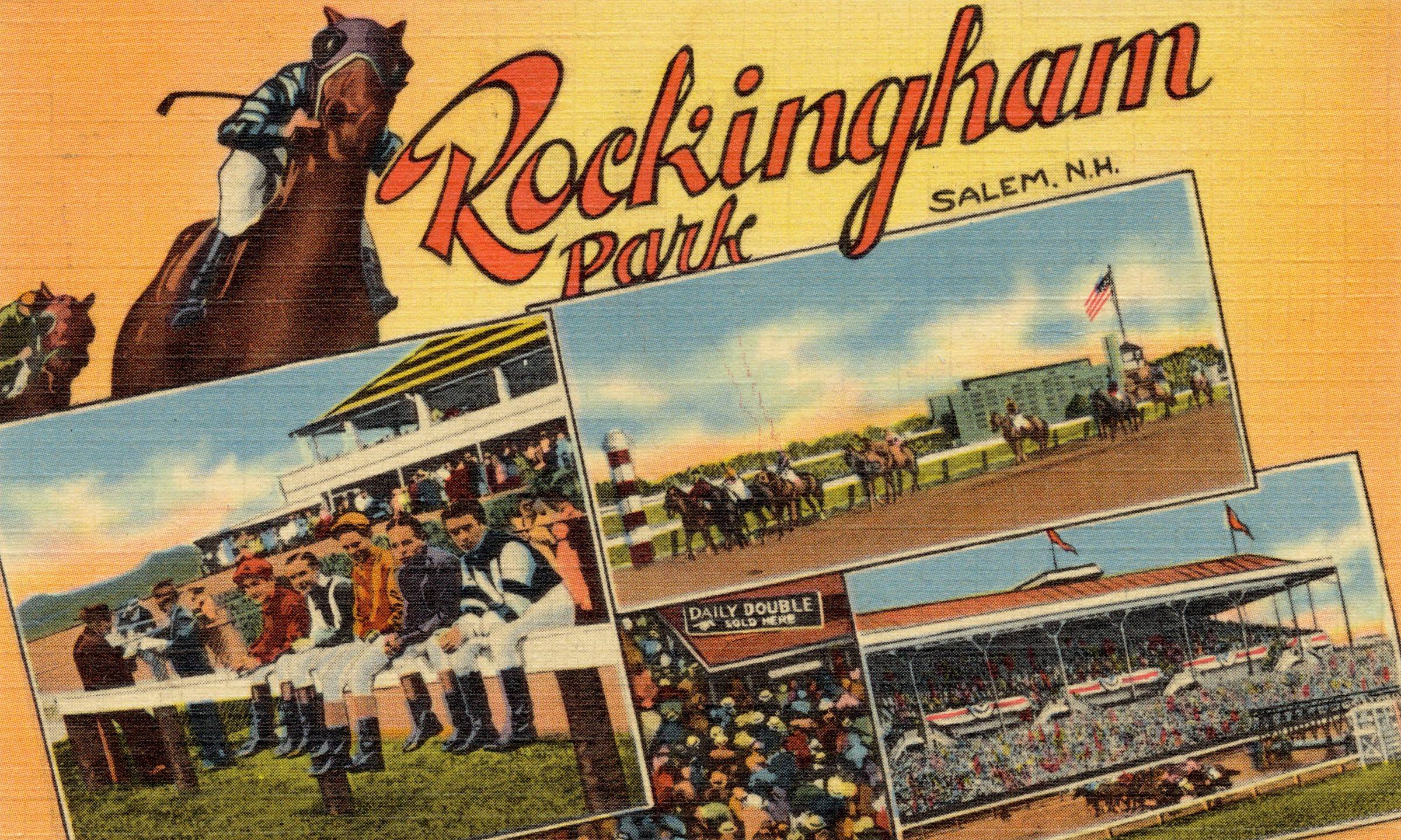
Rockingham Park opens
Rockingham Park opened as a horse racing track and quickly became one of New England's premier thoroughbred tracks. Special Boston & Maine Railroad trains brought thousands of racegoers from Boston, Lawrence and Haverhill on race days. For nearly a century the track was a major economic engine for Salem.
1945 · est. population 4,036
End of World War II
Salem men and women served in every theater of the war. Returning veterans brought new energy and set the stage for dramatic growth in the decades ahead.
1946 · est. population 4,190
Baby boom begins
The post-war baby boom turned Salem from a small rural community into a fast-growing suburb. Young families moved into new housing developments, and Salem's population nearly tripled in 20 years, from 3,267 in 1940 to 9,210 in 1960.
1950 · est. population 4,805
Route 28 widened to four lanes
As post-war traffic surged, Route 28 through Salem was widened from two lanes to four, making South Broadway one of southern New Hampshire's busiest commercial corridors. It fueled a wave of new businesses, shopping plazas and car-oriented development. (Source: Doug Seed, Merrimack Valley Life)
1961 · est. population 10,303
Interstate 93 built
Interstate 93 connected Salem directly to Boston and northern New Hampshire. Exits 1, 2 and 3 opened Salem to rapid suburban growth, changing it from a quiet farming community to a busy commercial center.
1991 · est. population 25,983
The Mall at Rockingham Park
The Mall at Rockingham Park opened next to the famous track, drawing on New Hampshire's tax-free shopping. With over 125 stores and major anchors, it made Salem the region's retail hub.
2016 · est. population 29,564
Tuscan Village redevelopment begins
After Rockingham Park closed, the 170-acre site began its change into Tuscan Village, a mixed-use development with shops, restaurants, medical offices, apartments and a Market Basket. It is one of the largest redevelopment projects in New Hampshire history.
2023
Town Charter adopted
Voters adopted Salem's Town Charter, 1,164 to 563. It replaced the five-member Board of Selectmen with a nine-member Town Council.
Census counts
| Year | Population | Change |
|---|---|---|
| 1790 | 1,218 | — |
| 1800 | 1,077 | −11.6% |
| 1810 | 1,179 | +9.5% |
| 1820 | 1,311 | +11.2% |
| 1830 | 1,310 | −0.1% |
| 1840 | 1,408 | +7.5% |
| 1850 | 1,555 | +10.4% |
| 1860 | 1,670 | +7.4% |
| 1870 | 1,603 | −4.0% |
| 1880 | 1,809 | +12.9% |
| 1890 | 1,805 | −0.2% |
| 1900 | 2,041 | +13.1% |
| 1910 | 2,117 | +3.7% |
| 1920 | 2,318 | +9.5% |
| 1930 | 2,751 | +18.7% |
| 1940 | 3,267 | +18.8% |
| 1950 | 4,805 | +47.1% |
| 1960 | 9,210 | +91.7% |
| 1970 | 20,142 | +118.7% |
| 1980 | 24,124 | +19.8% |
| 1990 | 25,746 | +6.7% |
| 2000 | 28,112 | +9.2% |
| 2010 | 28,776 | +2.4% |
| 2020 | 30,089 | +4.6% |
| 2024* | 31,673 | +5.3% |
* 2024 is a Census Bureau population estimate, not a census count.
Sources and notes
Population: U.S. Decennial Census, 1790–2020, and the Census Bureau’s 2024 population estimate. The “est. population” for each event is a straight-line estimate between census counts.
Charter vote: Town of Salem election results, March 2023. See Joe’s record.
Know a part of Salem’s history that belongs here? Tell Joe.